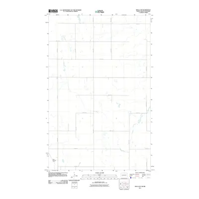
2011 Map of Rolla NE
USGS Topo · Published 2011About this map
The Rolla Municipal Airport sits at the southwestern edge of this North Dakota landscape, a high-plains region characterized by a strictly organized grid of agricultural roads. The terrain is marked by numerous small, scattered wetlands and depressions typical of the prairie pothole region, which influence the path of local thoroughfares like Airport Rd and 55th Ave Ne. While much of the land is dedicated to farming, the presence of Bison Dr and a network of numbered section-line roads, such as 109th St Ne and 102nd St Ne, reveals the precise 20th-century surveying that defined Rolette County. This 2011 survey by the U.S. Geological Survey shows how modern aviation infrastructure integrates into a traditional rural section-line system.
Find a feature on this map
16 named features on this map. Tap any name to fly to it.
Don’t see what you’re looking for? This feature index may not catch every label — zoom into the map to look around manually.
Map Details
Editions of this 2011 Rolla NE Map
This is the sole edition of this map. No revisions or reprints were ever made.
Other maps of this area

1953 · Devils Lake
USGS Topo · 1:250,000

1956 · Devils Lake
USGS Topo · 1:250,000

1968 · Belcourt
USGS Topo · 1:24,000
1969 · Hansboro
USGS Topo · 1:24,000

1969 · Saint John
USGS Topo · 1:24,000

1969 · Rolla NE
USGS Topo · 1:24,000

1970 · Hansboro SW
USGS Topo · 1:24,000

1970 · Rolla
USGS Topo · 1:24,000

1985 · Rock Lake
USGS Topo · 1:100,000
2011 · Belcourt
USGS Topo · 1:24,000