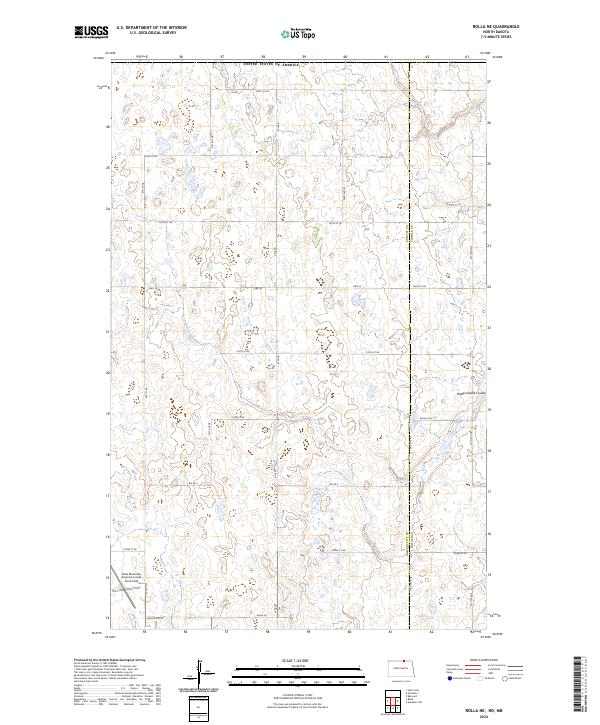
2024 Map of Rolla NE
USGS Topo · Published 2024About this map
Glacial potholes and prairie wetlands define this rural landscape along the international boundary between the United States of America and Canada. The terrain is characterized by a dense network of small water bodies and seasonal basins, typical of the drift prairie in north-central North Dakota. Transportation in this section of the Turtle Mountain region relies on a grid of section-line roads such as Kyle Rd and 51st Ave NE, which intersect with the arterial Hwy 43.
Find a feature on this map
26 named features on this map. Tap any name to fly to it.
Don’t see what you’re looking for? This feature index may not catch every label — zoom into the map to look around manually.
Map Details
Editions of this 2024 Rolla NE Map
This is the sole edition of this map. No revisions or reprints were ever made.
Other maps of this area

1953 · Devils Lake
USGS Topo · 1:250,000

1956 · Devils Lake
USGS Topo · 1:250,000

1968 · Belcourt
USGS Topo · 1:24,000
1969 · Hansboro
USGS Topo · 1:24,000

1969 · Saint John
USGS Topo · 1:24,000

1969 · Rolla NE
USGS Topo · 1:24,000

1970 · Hansboro SW
USGS Topo · 1:24,000

1970 · Rolla
USGS Topo · 1:24,000

1985 · Rock Lake
USGS Topo · 1:100,000
2011 · Belcourt
USGS Topo · 1:24,000