
1969 Map of Rolla NE
USGS Topo · Published 1972About this map
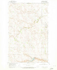
The international border between Canada and the United States defines the northern edge of this North Dakota landscape, where the prairie of Manitoba and North Dakota meets. The terrain is characterized by the winding path of Hidden Island Coulee, which snakes through the eastern portion of the map. This area, divided among the townships of Fairview, Picton, and Mount View, reflects the rural organization of Rolette and Towner Counties. In the southwest corner, the Rolla Municipal Airport and a nearby Country Club signal the expansion of local infrastructure and recreational life near the edge of the regional hub. The map provides a clear view of the section lines and drainage patterns that dictated the development of these borderland farming communities.
Find a feature on this map
9 named features on this map. Tap any name to fly to it.
Don’t see what you’re looking for? This feature index may not catch every label — zoom into the map to look around manually.
Map Details
Editions of this 1969 Rolla NE Map
This is the sole edition of this map. No revisions or reprints were ever made.
Other maps of this area

1953 · Devils Lake
USGS Topo · 1:250,000

1956 · Devils Lake
USGS Topo · 1:250,000

1968 · Belcourt
USGS Topo · 1:24,000
1969 · Hansboro
USGS Topo · 1:24,000

1969 · Saint John
USGS Topo · 1:24,000

1970 · Hansboro SW
USGS Topo · 1:24,000

1970 · Rolla
USGS Topo · 1:24,000

1985 · Rock Lake
USGS Topo · 1:100,000
2011 · Belcourt
USGS Topo · 1:24,000
2011 · Hansboro SW
USGS Topo · 1:24,000