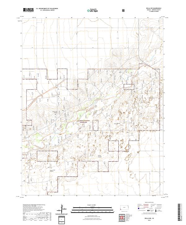
2022 Map of Rolla NW
USGS Topo · Published 2022About this map
The Cimarron National Grassland dominates this portion of Morton County, preserving a landscape defined by the winding course of the Cimarron River. This contemporary survey highlights the convergence of historic transit and modern conservation, most notably where the Santa Fe National Historic Trl and its accompanying Santa Fe National Historic Trl Companion Trl cross the plains. These paths represent a vital link to 19th-century westward expansion, running parallel to the river's path through the shortgrass prairie. The interior of the grassland is organized into large managed tracts such as North Lowe Pasture, South Lowe Pasture, and Bridge Pasture. These divisions, along with a grid of rural routes like RD 19 and RD 20, illustrate the enduring intersection of federal land management and the region's agricultural heritage.
Find a feature on this map
18 named features on this map. Tap any name to fly to it.
Don’t see what you’re looking for? This feature index may not catch every label — zoom into the map to look around manually.
Map Details
Editions of this 2022 Rolla NW Map
This is the sole edition of this map. No revisions or reprints were ever made.
Other maps of this area

1955 · Dodge City
USGS Topo · 1:250,000

1958 · Dodge City
USGS Topo · 1:250,000

1959 · Dodge City
USGS Topo · 1:250,000

1973 · Shore Airport SW
USGS Topo · 1:24,000

1973 · Rolla NW
USGS Topo · 1:24,000

1973 · Elkhart NE
USGS Topo · 1:24,000

1973 · Rolla NE
USGS Topo · 1:24,000
1973 · Richfield
USGS Topo · 1:24,000
1974 · Rolla SE
USGS Topo · 1:24,000
1974 · Wilburton
USGS Topo · 1:24,000