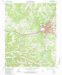
1985 Map of Rolla
USGS Topo · Published 1985About this map
The Univ of Missouri - Rolla campus anchors the northeast corner of this Phelps County landscape, where the growing urban center of Rolla meets the dense woodlands of the Mark Twain National Forest. The 1980s infrastructure is well-defined by the path of Interstate 44 and the activity at the Rolla Downtown Airport. Beyond the city limits, the terrain transitions into the rugged hollows and creek beds of the Ozark Plateau, marked by subterranean features like Poole Hollow Cave and Little Beaver Cave.
Find a feature on this map
71 named features on this map. Tap any name to fly to it.
Don’t see what you’re looking for? This feature index may not catch every label — zoom into the map to look around manually.
Map Details
Editions of this 1985 Rolla Map
This is the sole edition of this map. No revisions or reprints were ever made.
Other maps of this area

1912 · Rolla
USGS Topo · 1:62,500

1928 · Meramec Spring
USGS Topo · 1:62,500

1934 · Redbird
USGS Topo · 1:62,500

1937 · Vienna
USGS Topo · 1:62,500

1938 · Redbird
USGS Topo · 1:62,500

1938 · Vienna
USGS Topo · 1:48,000

1949 · Saint Louis
USGS Topo · 1:250,000

1949 · Vienna
USGS Topo · 1:62,500

1949 · Rolla
USGS Topo · 1:250,000

1949 · Meramec Spring
USGS Topo · 1:62,500