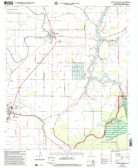
2000 Map of Rolling Fork East
USGS Topo · Published 2002About this map
The Big Sunflower River defines the landscape of the Mississippi Delta at the turn of the millennium, winding through a complex network of bayous and managed floodlands. This era in Sharkey County shows the deep integration of the local economy with the river system, as evidenced by numerous named landings such as Hickman Landing and Ratliff Landing that dot the riverbanks. The map illustrates the transition from the cultivated fields around Anguilla and Mount Helena to the protected bottomland hardwood forests of the Delta National Forest.
Find a feature on this map
37 named features on this map. Tap any name to fly to it.
Don’t see what you’re looking for? This feature index may not catch every label — zoom into the map to look around manually.
Map Details
Editions of this 2000 Rolling Fork East Map
This is the sole edition of this map. No revisions or reprints were ever made.
Other maps of this area

1939 · Lorenzen
USGS Topo · 1:62,500

1939 · Swan Lake
USGS Topo · 1:62,500

1940 · Auter
USGS Topo · 1:62,500

1953 · Greenwood
USGS Topo · 1:250,000

1955 · Jackson
USGS Topo · 1:250,000

1956 · Greenwood
USGS Topo · 1:250,000

1961 · Jackson
USGS Topo · 1:250,000

1961 · Bayland
USGS Topo · 1:62,500

1962 · Jackson
USGS Topo · 1:250,000

1964 · Lorenzen
USGS Topo · 1:62,500