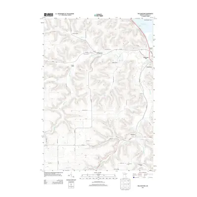
2013 Map of Rollingstone
USGS Topo · Published 2013About this map
Rollingstone and the surrounding coulees of Winona County are defined by a complex network of valleys and ridges carved by tributaries of the Mississippi River. The settlement of Minnesota City sits at the eastern edge where Garvin Brook meets the broader Mississippi floodplains, while Stockton occupies a narrow valley to the south. This 2013 survey illustrates the dramatic elevation changes characteristic of the driftless area, from the high grounds of German Ridge and The Arches down to the low-lying Dark Slough and Snyder Lake near Island Number Sixty. Agricultural patterns follow the topography, with roads like Co HWY-25 and MN-248 tracing the winding valley floors. For local history, the map preserves the location of the Mecklenburg Cem and several distinct family-named valleys, including Preston Valley, Middle Valley, and Schoeniger Valley, which point to the historic settlement patterns of the region.
Find a feature on this map
64 named features on this map. Tap any name to fly to it.
Don’t see what you’re looking for? This feature index may not catch every label — zoom into the map to look around manually.
Map Details
Editions of this 2013 Rollingstone Map
This is the sole edition of this map. No revisions or reprints were ever made.
Other maps of this area

1929 · Fountain City
USGS Topo · 1:62,500

1932 · Cochrane
USGS Topo · 1:62,500

1934 · Winona
USGS Topo · 1:62,500

1934 · Cochrane
USGS Topo · 1:62,500

1937 · Winona
USGS Topo · 1:62,500

1937 · Cochrane
USGS Topo · 1:62,500

1953 · Eau Claire
USGS Topo · 1:250,000

1954 · Lewiston
USGS Topo · 1:62,500

1958 · Eau Claire
USGS Topo · 1:250,000

1958 · Houston
USGS Topo · 1:62,500