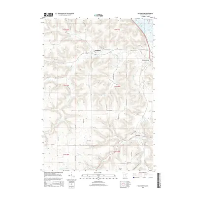
2016 Map of Rollingstone
USGS Topo · Published 2016About this map
Rollingstone and Stockton serve as the primary nodes of settlement in this Winona County landscape, where deep valleys and ridges dictate the movement of both water and roads. The terrain is characterized by a series of prominent drainages, including Preston Valley, Middle Valley, and Stockton Valley, through which Garvin Brook and Rollingstone Cr flow toward the Mississippi River floodplain. Along the northeastern edge, the map documents the complex water network of Island Number Sixty, bordered by Dark Slough and Straight Slough. Local history is anchored by sites like the Mecklenburg Cem near German Ridge, while the rural road network, featuring routes such as Hoffman Hill Rd and Fern Valley Rd, follows the natural contours of the bluff country. This survey illustrates the persistent agricultural and residential patterns of the region well into the twenty-first century.
Find a feature on this map
78 named features on this map. Tap any name to fly to it.
Don’t see what you’re looking for? This feature index may not catch every label — zoom into the map to look around manually.
Map Details
Editions of this 2016 Rollingstone Map
This is the sole edition of this map. No revisions or reprints were ever made.
Other maps of this area

1929 · Fountain City
USGS Topo · 1:62,500

1932 · Cochrane
USGS Topo · 1:62,500

1934 · Winona
USGS Topo · 1:62,500

1934 · Cochrane
USGS Topo · 1:62,500

1937 · Winona
USGS Topo · 1:62,500

1937 · Cochrane
USGS Topo · 1:62,500

1953 · Eau Claire
USGS Topo · 1:250,000

1954 · Lewiston
USGS Topo · 1:62,500

1958 · Eau Claire
USGS Topo · 1:250,000

1958 · Houston
USGS Topo · 1:62,500