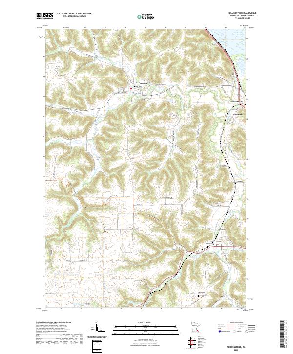
2022 Map of Rollingstone
USGS Topo · Published 2022About this map
Rollingstone sits at the nexus of several deep coulees in the driftless area of southeast Minnesota, where Rollingstone Cr carves through the blufflands. The town is anchored by the Holy Trinity Catholic Cem, reflecting the deep-rooted local heritage of this river-valley community. Further south, the village of Stockton occupies the floor of Stockton Valley, where Garvin Brook flows toward the Mississippi backwaters.
Find a feature on this map
82 named features on this map. Tap any name to fly to it.
Don’t see what you’re looking for? This feature index may not catch every label — zoom into the map to look around manually.
Map Details
Editions of this 2022 Rollingstone Map
This is the sole edition of this map. No revisions or reprints were ever made.
Other maps of this area

1929 · Fountain City
USGS Topo · 1:62,500

1932 · Cochrane
USGS Topo · 1:62,500

1934 · Winona
USGS Topo · 1:62,500

1934 · Cochrane
USGS Topo · 1:62,500

1937 · Winona
USGS Topo · 1:62,500

1937 · Cochrane
USGS Topo · 1:62,500

1953 · Eau Claire
USGS Topo · 1:250,000

1954 · Lewiston
USGS Topo · 1:62,500

1958 · Eau Claire
USGS Topo · 1:250,000

1958 · Houston
USGS Topo · 1:62,500