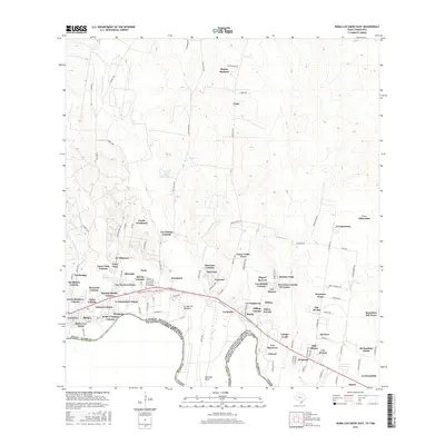
2016 Map of Roma-Los Saenz East
USGS Topo · Published 2016About this map
The Rio Grande serves as the international boundary between Starr County, Texas, and the United States and Mexico in this 2016 survey. The landscape is defined by a dense corridor of settlements and colonias following the river's path, including Escobares, Garceno, and the eastern reaches of Roma-Los Saenz. Local genealogy is anchored by sites such as the Cementerio San Antonio de Escobares near Old Escobares Hwy 83. Away from the river, the terrain transitions into a network of arroyos and family-named landmarks like Regino Ramirez and Casas. Significant drainage features including Arroyo Garceño and Arroyo los Morenos cut through the brush country toward Guerrero Lake, illustrating the complex hydrology of the borderlands. The road network, from Garceno Road to numerous loop roads, reflects the established community structure of these South Texas townships.
Find a feature on this map
122 named features on this map. Tap any name to fly to it.
Don’t see what you’re looking for? This feature index may not catch every label — zoom into the map to look around manually.
Map Details
Editions of this 2016 Roma-Los Saenz East Map
This is the sole edition of this map. No revisions or reprints were ever made.
Other maps of this area

1938 · Falcon
USGS Topo · 1:62,500

1938 · El Sauz
USGS Topo · 1:62,500

1949 · Mc Allen
USGS Topo · 1:250,000

1954 · McAllen
USGS Topo · 1:250,000

1956 · Escobares
USGS Topo · 1:62,500

1956 · Roma
USGS Topo · 1:62,500

1957 · Mc Allen
USGS Topo · 1:250,000

1962 · McAllen
USGS Topo · 1:250,000

1965 · Rio Grande City South
USGS Topo · 1:24,000

1965 · Los Garzas
USGS Topo · 1:24,000