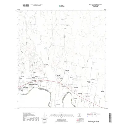
2019 Map of Roma-Los Saenz East
USGS Topo · Published 2019About this map
The Rio Grande snakes along the international border, defining the southern limit of this Starr County landscape. In the late 2010s, this corridor shows a dense network of residential colonias and settlements following the path of the river and highway. Central to the area is the community of Escobares, where the Cementerio San Antonio de Escobares provides a significant touchstone for local family history and genealogy. To the west, the historic center of Roma and Roma-Los Saenz marks the urban anchor of the quadrangle.
Find a feature on this map
101 named features on this map. Tap any name to fly to it.
Don’t see what you’re looking for? This feature index may not catch every label — zoom into the map to look around manually.
Map Details
Editions of this 2019 Roma-Los Saenz East Map
This is the sole edition of this map. No revisions or reprints were ever made.
Other maps of this area
1938 · Falcon
USGS Topo · 1:62,500
1938 · El Sauz
USGS Topo · 1:62,500

1949 · Mc Allen
USGS Topo · 1:250,000

1954 · McAllen
USGS Topo · 1:250,000
1956 · Escobares
USGS Topo · 1:62,500
1956 · Roma
USGS Topo · 1:62,500

1957 · Mc Allen
USGS Topo · 1:250,000

1962 · McAllen
USGS Topo · 1:250,000
1965 · Rio Grande City South
USGS Topo · 1:24,000
1965 · Los Garzas
USGS Topo · 1:24,000