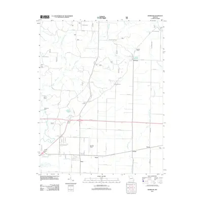
2011 Map of Rombauer
USGS Topo · Published 2011About this map
Rombauer sits at the heart of this landscape where the undulating hills of the Ozark foothills meet the drainage systems of the Missouri Bootheel. The geography is defined by a transition from the winding courses of Indian Creek and Franklin Creek in the north to the more straightened, managed water of Snyder Ditch and the Black River to the south. This area includes a series of small, interconnected settlements like Hamtown, Empire, and Lowell Junction, suggesting a history of localized community hubs along rural corridors such as Old Hwy T.
Find a feature on this map
76 named features on this map. Tap any name to fly to it.
Don’t see what you’re looking for? This feature index may not catch every label — zoom into the map to look around manually.
Map Details
Editions of this 2011 Rombauer Map
This is the sole edition of this map. No revisions or reprints were ever made.
Other maps of this area

1934 · Puxico
USGS Topo · 1:62,500

1935 · Poplar Bluff
USGS Topo · 1:62,500

1935 · Harviell
USGS Topo · 1:62,500

1939 · Puxico
USGS Topo · 1:62,500

1939 · Poplar Bluff
USGS Topo · 1:62,500

1940 · Valley Ridge
USGS Topo · 1:62,500

1949 · Poplar Bluff
USGS Topo · 1:62,500

1956 · Valley Ridge
USGS Topo · 1:62,500

1957 · Poplar Bluff
USGS Topo · 1:250,000

1959 · Poplar Bluff
USGS Topo · 1:250,000