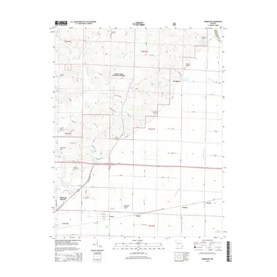
2015 Map of Rombauer
USGS Topo · Published 2015About this map
Poplar Bluff sits at the edge of this landscape where the Ozark foothills meet the alluvial plains of Southeast Missouri. The northern reaches are characterized by the heavy timber of the Mark Twain National Forest, dissected by drainages like Franklin Cr and W Prong Indian Cr. To the south and east, the terrain levels significantly, giving way to the complex drainage networks of Blue Spring Slough and Snyder Ditch that define the agricultural lowlands.
Find a feature on this map
97 named features on this map. Tap any name to fly to it.
Don’t see what you’re looking for? This feature index may not catch every label — zoom into the map to look around manually.
Map Details
Editions of this 2015 Rombauer Map
This is the sole edition of this map. No revisions or reprints were ever made.
Other maps of this area

1934 · Puxico
USGS Topo · 1:62,500

1935 · Poplar Bluff
USGS Topo · 1:62,500

1935 · Harviell
USGS Topo · 1:62,500

1939 · Puxico
USGS Topo · 1:62,500

1939 · Poplar Bluff
USGS Topo · 1:62,500

1940 · Valley Ridge
USGS Topo · 1:62,500

1949 · Poplar Bluff
USGS Topo · 1:62,500

1956 · Valley Ridge
USGS Topo · 1:62,500

1957 · Poplar Bluff
USGS Topo · 1:250,000

1959 · Poplar Bluff
USGS Topo · 1:250,000