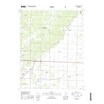
2017 Map of Rombauer
USGS Topo · Published 2017About this map
The Mark Twain National Forest dominates the northern reaches of this Butler County landscape, where the terrain is defined by the winding paths of Cattail Cr and the W Prong Indian Cr. Small communities and agricultural clusters such as Rombauer, Barron, and Junland are scattered across the lower elevations, connected by an extensive network of county roads. The area shows a high density of rural burial grounds, including Huffman Cem and Blue Spring Cem, which serve as vital markers for local genealogical research. In the southwest, the outskirts of Poplar Bluff transition into infrastructure like the Poplar Bluff Municipal Airport, while the eastern border is marked by the complex drainage systems of Blue Spring Slough and Snyder Ditch, reflecting the managed water patterns of the Missouri Bootheel region.
Find a feature on this map
86 named features on this map. Tap any name to fly to it.
Don’t see what you’re looking for? This feature index may not catch every label — zoom into the map to look around manually.
Map Details
Editions of this 2017 Rombauer Map
This is the sole edition of this map. No revisions or reprints were ever made.
Other maps of this area

1934 · Puxico
USGS Topo · 1:62,500

1935 · Poplar Bluff
USGS Topo · 1:62,500

1935 · Harviell
USGS Topo · 1:62,500

1939 · Puxico
USGS Topo · 1:62,500

1939 · Poplar Bluff
USGS Topo · 1:62,500

1940 · Valley Ridge
USGS Topo · 1:62,500

1949 · Poplar Bluff
USGS Topo · 1:62,500

1956 · Valley Ridge
USGS Topo · 1:62,500

1957 · Poplar Bluff
USGS Topo · 1:250,000

1959 · Poplar Bluff
USGS Topo · 1:250,000