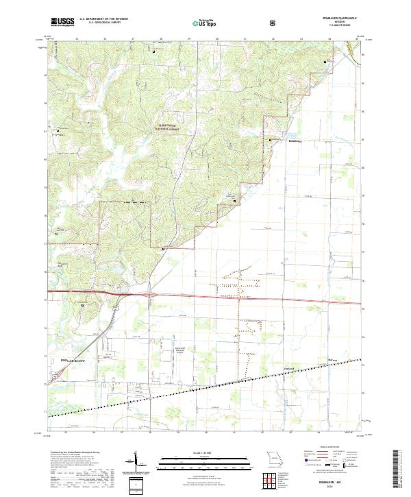
2021 Map of Rombauer
USGS Topo · Published 2021About this map
Poplar Bluff and its surrounding countryside define this modern-day landscape where the Ozark foothills meet the Mississippi embayment. The northeastern section is dominated by the Mark Twain National Forest, an area of dense drainage networks including Franklin Cr and W Prong Indian Cr. Below these forested slopes, the terrain transitions into a more structured agricultural and municipal grid. Several family-named cemeteries such as Huffman Cem, Dooley Cem, and Stephenson Cem are scattered throughout the hills and flats, offering a wealth of information for genealogists and local historians.
Find a feature on this map
81 named features on this map. Tap any name to fly to it.
Don’t see what you’re looking for? This feature index may not catch every label — zoom into the map to look around manually.
Map Details
Editions of this 2021 Rombauer Map
This is the sole edition of this map. No revisions or reprints were ever made.
Other maps of this area

1934 · Puxico
USGS Topo · 1:62,500

1935 · Poplar Bluff
USGS Topo · 1:62,500

1935 · Harviell
USGS Topo · 1:62,500

1939 · Puxico
USGS Topo · 1:62,500

1939 · Poplar Bluff
USGS Topo · 1:62,500

1940 · Valley Ridge
USGS Topo · 1:62,500

1949 · Poplar Bluff
USGS Topo · 1:62,500

1956 · Valley Ridge
USGS Topo · 1:62,500

1957 · Poplar Bluff
USGS Topo · 1:250,000

1959 · Poplar Bluff
USGS Topo · 1:250,000