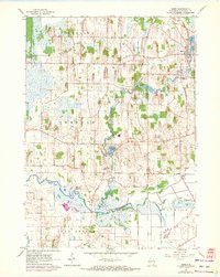
1960 Map of Rome
USGS Topo · Published 1972About this map
The Bark River winds through the heart of Jefferson County in this 1960s study, shaping a landscape of marshy lowlands and mill ponds. The settlement of Rome sits at the northern edge, anchored by Rome Pond and surrounded by family legacy sites like St Lukes Cem and Hoffman Cem. To the south, the village of Hebron and the smaller cluster at Slabtown reflect the mid-century rural economy of southeast Wisconsin. The prominence of features like the Cushman Mill Sch and Cushman Pond suggests the long-standing importance of water power in this region. Further south, the Scuppernong River joins the drainage system, where the Princess Point Bridge provides a vital crossing over the wet prairie and river bottom. The map captures a transition period, with purple revisions from 1971 noting changes in the terrain around Green Isle Lake and several unnamed gravel pits.
Find a feature on this map
30 named features on this map. Tap any name to fly to it.
Don’t see what you’re looking for? This feature index may not catch every label — zoom into the map to look around manually.
Map Details
Editions of this 1960 Rome Map
2 editions found
Other maps of this area

1891 · Waterloo
USGS Topo · 1:62,500

1891 · Koshkonong
USGS Topo · 1:62,500

1892 · Watertown
USGS Topo · 1:62,500

1892 · Whitewater
USGS Topo · 1:62,500

1893 · Whitewater
USGS Topo · 1:62,500

1894 · Waterloo
USGS Topo · 1:62,500

1894 · Watertown
USGS Topo · 1:62,500

1894 · Koshkonong
USGS Topo · 1:62,500

1903 · Whitewater
USGS Topo · 1:62,500

1906 · Koshkonong
USGS Topo · 1:62,500