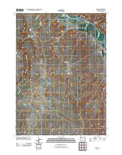
2011 Map of Rome
USGS Topo · Published 2011About this map
Rome sits at a strategic crossing where Jordan Creek meets the Owyhee River, serving as a remote outpost in Malheur County. The landscape is defined by its water management and ranching legacy, evidenced by the presence of Crooked Creek Ranch and the long courses of the Happy Valley Ditch, Hubble Ditch, and Scott Ditch that lace through the arid terrain. These irrigation systems suggest a complex history of desert reclamation and agricultural endurance near Happy Valley.
Find a feature on this map
16 named features on this map. Tap any name to fly to it.
Don’t see what you’re looking for? This feature index may not catch every label — zoom into the map to look around manually.
Map Details
Editions of this 2011 Rome Map
This is the sole edition of this map. No revisions or reprints were ever made.
Other maps of this area
1955 · Jordan Valley
USGS Topo · 1:250,000
1957 · Jordan Valley
USGS Topo · 1:250,000
1958 · Jordan Valley
USGS Topo · 1:250,000
1972 · Owyhee Butte
USGS Topo · 1:24,000
1972 · Rome
USGS Topo · 1:24,000
1972 · Scott Reservoir
USGS Topo · 1:24,000
1972 · Arock
USGS Topo · 1:24,000
1972 · Iron Mountain
USGS Topo · 1:24,000
1972 · Burns Junction
USGS Topo · 1:24,000
1979 · Rockhouse Reservoir
USGS Topo · 1:24,000