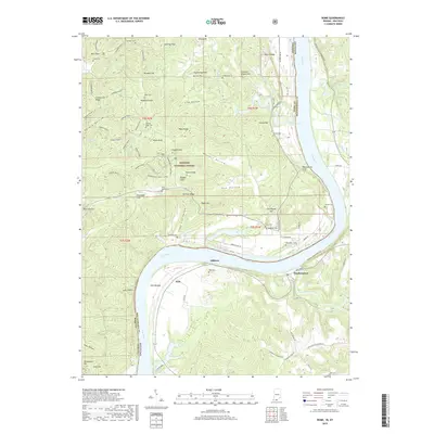
2019 Map of Rome
USGS Topo · Published 2019About this map
The Ohio River carves a dramatic oxbow curve through the borderlands of Indiana and Kentucky, anchoring the life and geography of this riverine corridor. On the Kentucky side, the settlements of Stephensport, Addison, and Holt sit along the southern bank, where the land transitions from the fertile Holt Bottom to the high elevations of Drinkwater Hill. Numerous small family and community burial grounds, such as Shoemaker Cem and Burk Cem, are tucked into the rising slopes above the water, offering critical data points for genealogists tracking early river valley families.
Find a feature on this map
93 named features on this map. Tap any name to fly to it.
Don’t see what you’re looking for? This feature index may not catch every label — zoom into the map to look around manually.
Map Details
Editions of this 2019 Rome Map
This is the sole edition of this map. No revisions or reprints were ever made.
Other maps of this area

1928 · Hardinsburg
USGS Topo · 1:48,000

1931 · Hardinsburg
USGS Topo · 1:62,500

1934 · Cannelton
USGS Topo · 1:62,500

1947 · Lodiburg
USGS Topo · 1:24,000

1947 · Hardinsburg
USGS Topo · 1:24,000

1947 · Hardinsburg
USGS Topo · 1:62,500

1949 · Cannelton
USGS Topo · 1:24,000

1950 · Alton
USGS Topo · 1:62,500

1950 · Alton
USGS Topo · 1:24,000

1951 · Alton
USGS Topo · 1:24,000