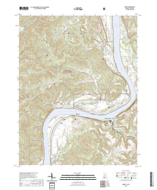
2022 Map of Rome
USGS Topo · Published 2022About this map
The Ohio River carves a deep, winding path through this portion of the Indiana-Kentucky border, creating a landscape of high ridges and secluded hollows. On the Kentucky side, Stephensport sits near the mouth of Sinking Creek, while across the water in Indiana, the small settlements of Addison and Holt occupy the narrow floodplains below the bluffs. The interior of the map is dominated by the Hoosier National Forest, where the complex topography includes German Ridge and notable landmarks like Rickert Cliffs and Idle George Cliff.
Find a feature on this map
98 named features on this map. Tap any name to fly to it.
Don’t see what you’re looking for? This feature index may not catch every label — zoom into the map to look around manually.
Map Details
Editions of this 2022 Rome Map
This is the sole edition of this map. No revisions or reprints were ever made.
Other maps of this area

1928 · Hardinsburg
USGS Topo · 1:48,000

1931 · Hardinsburg
USGS Topo · 1:62,500

1934 · Cannelton
USGS Topo · 1:62,500

1947 · Lodiburg
USGS Topo · 1:24,000

1947 · Hardinsburg
USGS Topo · 1:24,000

1947 · Hardinsburg
USGS Topo · 1:62,500

1949 · Cannelton
USGS Topo · 1:24,000

1950 · Alton
USGS Topo · 1:62,500

1950 · Alton
USGS Topo · 1:24,000

1951 · Alton
USGS Topo · 1:24,000