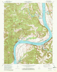
1970 Map of Rome
USGS Topo · Published 1972About this map
The Ohio River carves a deep, winding path through this 1970 landscape, defining the boundary between Perry County, Indiana, and Breckinridge County, Kentucky. On the northern banks, the hills of the Hoosier National Forest rise sharply, dotted with family names like Riggs Hill and Tom Bryant Hill. The community of Rome sits at a prominent bend in the river, serving as a focal point for a region characterized by rugged ridges and numerous small cemeteries, including Schraner Cem, Maier Cem, and Wegenast Cem. Across the water in Kentucky, the Louisville and Nashville railroad follows the riverbank, connecting small riverbank settlements like Stephensport, Addison, and Sample. The map reveals a deeply etched topography where Poison Creek and Deer Creek have carved significant valleys, while the German Ridge Lookout Tower stands as a sentinel over the forested highlands to the north.
Find a feature on this map
66 named features on this map. Tap any name to fly to it.
Don’t see what you’re looking for? This feature index may not catch every label — zoom into the map to look around manually.
Map Details
Editions of this 1970 Rome Map
This is the sole edition of this map. No revisions or reprints were ever made.
Other maps of this area

1928 · Hardinsburg
USGS Topo · 1:48,000

1931 · Hardinsburg
USGS Topo · 1:62,500

1934 · Cannelton
USGS Topo · 1:62,500

1947 · Lodiburg
USGS Topo · 1:24,000

1947 · Hardinsburg
USGS Topo · 1:24,000

1947 · Hardinsburg
USGS Topo · 1:62,500

1949 · Cannelton
USGS Topo · 1:24,000

1950 · Alton
USGS Topo · 1:62,500

1950 · Alton
USGS Topo · 1:24,000

1951 · Alton
USGS Topo · 1:24,000