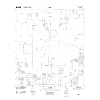
2012 Map of Romeo
USGS Topo · Published 2012About this map
Romeo and its surrounding communities in Marion County are situated within a landscape defined by isolated water bodies and expansive grasslands. The settlement pattern here includes the smaller localities of Luddersville, Hoyt, and the residential layout of Rainbow Park to the southeast. A unique topographical feature, the Dry Cow House Prairie, occupies a significant portion of the north-central area, surrounded by smaller catchments such as Kitchen Cow House Pond, Priest Pond, and Mooney Pond. Genealogists and local historians will find the Zion Hill Cem near Buck Pond, serving as a central landmark for tracing family roots in this rural corridor. The map reveals a transition from these open prairie landscapes to a structured grid of residential streets as the area underwent modern development near the turn of the 21st century.
Find a feature on this map
114 named features on this map. Tap any name to fly to it.
Don’t see what you’re looking for? This feature index may not catch every label — zoom into the map to look around manually.
Map Details
Editions of this 2012 Romeo Map
This is the sole edition of this map. No revisions or reprints were ever made.
Other maps of this area

1892 · Dunnellon
USGS Topo · 1:62,500

1894 · Dunnellon
USGS Topo · 1:62,500

1895 · Williston
USGS Topo · 1:62,500

1954 · Romeo
USGS Topo · 1:24,000

1954 · Dunnellon
USGS Topo · 1:24,000

1954 · Cotton Plant
USGS Topo · 1:24,000

1954 · Dunnellon SE
USGS Topo · 1:24,000

1954 · Yankeetown SE
USGS Topo · 1:24,000

1954 · Dunnellon
USGS Topo · 1:62,500

1954 · Gainesville
USGS Topo · 1:250,000