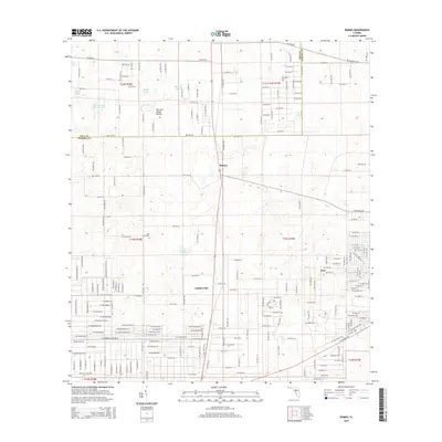
2015 Map of Romeo
USGS Topo · Published 2015About this map
Romeo and Luddersville sit at the center of this rural Marion County landscape, where the sandy terrain of north-central Florida is punctuated by numerous isolated ponds and basins. The topography is defined by distinctive features such as Kitchen Cow House Pond and Dry Cow House Prairie, illustrating the area's history of cattle ranching and seasonal grazing. The Levy Co Marion Co boundary runs along the northern portion of the map, marking the transition between jurisdictions. Genealogists and local historians can locate the Zion Hill Cem and the settlement of Hoyt, while a dense grid of residential roads like SW Rainbow Lakes Blvd and SW Beach Blvd suggests planned developments carving into the traditional timber and agricultural lands of the region.
Find a feature on this map
49 named features on this map. Tap any name to fly to it.
Don’t see what you’re looking for? This feature index may not catch every label — zoom into the map to look around manually.
Map Details
Editions of this 2015 Romeo Map
This is the sole edition of this map. No revisions or reprints were ever made.
Other maps of this area

1892 · Dunnellon
USGS Topo · 1:62,500

1894 · Dunnellon
USGS Topo · 1:62,500

1895 · Williston
USGS Topo · 1:62,500

1954 · Romeo
USGS Topo · 1:24,000

1954 · Dunnellon
USGS Topo · 1:24,000

1954 · Cotton Plant
USGS Topo · 1:24,000

1954 · Dunnellon SE
USGS Topo · 1:24,000

1954 · Yankeetown SE
USGS Topo · 1:24,000

1954 · Dunnellon
USGS Topo · 1:62,500

1954 · Gainesville
USGS Topo · 1:250,000