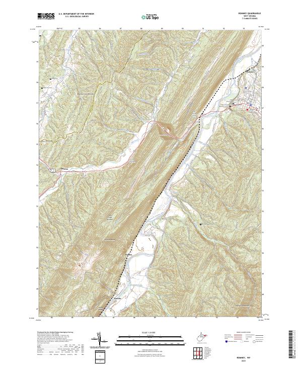
2023 Map of Romney
USGS Topo · Published 2023About this map
Romney sits as a historic center along the South Branch Potomac River, where the landscape is defined by the massive ridges of Patterson Creek Mountain and Nathaniel Mountain. This survey details a terrain of deep runs and springs, including Romney Spring and Clifford Parker Spring, which have long shaped settlement patterns in Hampshire Co. The map illustrates the concentration of civic life at the Hampshire County Judicial Center and preserved history at the Indian Mound Cem.
Find a feature on this map
82 named features on this map. Tap any name to fly to it.
Don’t see what you’re looking for? This feature index may not catch every label — zoom into the map to look around manually.
Map Details
Editions of this 2023 Romney Map
This is the sole edition of this map. No revisions or reprints were ever made.
Other maps of this area

1891 · Romney
USGS Topo · 1:125,000

1920 · Moorefield
USGS Topo · 1:62,500

1920 · Keyser
USGS Topo · 1:62,500

1921 · Keyser
USGS Topo · 1:48,000

1921 · Hanging Rock
USGS Topo · 1:48,000

1921 · Moorefield
USGS Topo · 1:48,000

1922 · Moorefield
USGS Topo · 1:62,500

1922 · Wardensville
USGS Topo · 1:62,500

1922 · Keyser
USGS Topo · 1:62,500

1923 · Hanging Rock
USGS Topo · 1:62,500