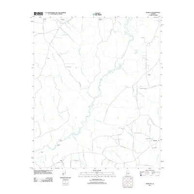
2011 Map of Romulus
USGS Topo · Published 2011About this map
The Sipsey River meanders extensively through this rural Alabama landscape, defining the movement and settlement patterns near Jena and Romulus. In this early 21st-century record, the river's influence is evident in the naming of river crossings such as Huffmans Ford, Gregorys Ford, and Turkey Ford, which recall a time of localized river transit before modern bridging. The interior is a network of small creeks and branches, including the curiously named Malone Mill Creek, suggesting the site of earlier industry along its banks.
Find a feature on this map
62 named features on this map. Tap any name to fly to it.
Don’t see what you’re looking for? This feature index may not catch every label — zoom into the map to look around manually.
Map Details
Editions of this 2011 Romulus Map
This is the sole edition of this map. No revisions or reprints were ever made.
Other maps of this area

1924 · Tuscaloosa
USGS Topo · 1:62,500

1926 · Samantha
USGS Topo · 1:48,000

1926 · Tuscaloosa
USGS Topo · 1:62,500

1928 · Samantha
USGS Topo · 1:62,500

1953 · Birmingham
USGS Topo · 1:250,000

1956 · Birmingham
USGS Topo · 1:250,000

1957 · Birmingham
USGS Topo · 1:250,000

1967 · Gordo
USGS Topo · 1:24,000

1967 · Elrod
USGS Topo · 1:24,000
1969 · Fosters
USGS Topo · 1:24,000