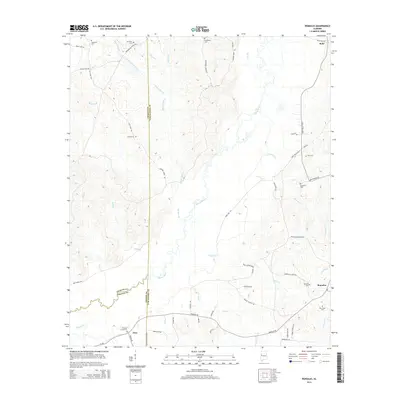
2014 Map of Romulus
USGS Topo · Published 2014About this map
The Sipsey River meanders through the heart of this West Alabama landscape, defining the rural character of the borderlands between Tuscaloosa, Greene, and Pickens counties. In the southeast, the settlement of Romulus sits near Romulus Cem and New Hope Cem, while the small community of Jena is located further west near Pleasant Grove Cem. The map reveals a deeply rooted rural infrastructure of family-named landmarks and old church sites, including Backbone Cem and Mt Olive Cem to the north.
Find a feature on this map
65 named features on this map. Tap any name to fly to it.
Don’t see what you’re looking for? This feature index may not catch every label — zoom into the map to look around manually.
Map Details
Editions of this 2014 Romulus Map
This is the sole edition of this map. No revisions or reprints were ever made.
Other maps of this area

1924 · Tuscaloosa
USGS Topo · 1:62,500

1926 · Samantha
USGS Topo · 1:48,000

1926 · Tuscaloosa
USGS Topo · 1:62,500

1928 · Samantha
USGS Topo · 1:62,500

1953 · Birmingham
USGS Topo · 1:250,000

1956 · Birmingham
USGS Topo · 1:250,000

1957 · Birmingham
USGS Topo · 1:250,000

1967 · Gordo
USGS Topo · 1:24,000

1967 · Elrod
USGS Topo · 1:24,000
1969 · Fosters
USGS Topo · 1:24,000