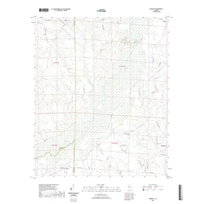
2020 Map of Romulus
USGS Topo · Published 2020About this map
Romulus and Jena anchor this West Alabama landscape where the borders of Greene, Pickens, and Tuscaloosa counties converge. The area is defined by the broad, marshy basin of the Sipsey River, which meanders through the Sipsey Swamp and is joined by numerous tributaries including Beaverdam Branch and Engine Creek. These wetlands create a natural buffer between the upland settlements, visible in the dense network of unpaved roads and forest tracts.
Find a feature on this map
73 named features on this map. Tap any name to fly to it.
Don’t see what you’re looking for? This feature index may not catch every label — zoom into the map to look around manually.
Map Details
Editions of this 2020 Romulus Map
This is the sole edition of this map. No revisions or reprints were ever made.
Other maps of this area

1924 · Tuscaloosa
USGS Topo · 1:62,500

1926 · Samantha
USGS Topo · 1:48,000

1926 · Tuscaloosa
USGS Topo · 1:62,500

1928 · Samantha
USGS Topo · 1:62,500

1953 · Birmingham
USGS Topo · 1:250,000

1956 · Birmingham
USGS Topo · 1:250,000

1957 · Birmingham
USGS Topo · 1:250,000

1967 · Gordo
USGS Topo · 1:24,000

1967 · Elrod
USGS Topo · 1:24,000
1969 · Fosters
USGS Topo · 1:24,000