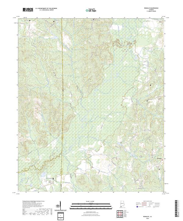
2024 Map of Romulus
USGS Topo · Published 2024About this map
The Sipsey River and its vast Sipsey Swamp anchor this landscape along the border of Tuscaloosa, Pickens, and Greene counties. The area is defined by a series of small, dispersed settlements such as Romulus and Jena, where rural life is centered around longstanding community landmarks. Genealogists will find a wealth of burial sites, including the Romulus Cem, Caledonia Cem, and Pate Cem, which often represent the early families of this river bottom region. Numerous small waterways, such as Malone Mill Creek and Beaverdam Branch, drain into the Sipsey, illustrating a drainage pattern that has historically dictated road placement and land use. Local transport is facilitated by a network of secondary routes like Sipsey Valley Rd and Backbone Church Rd, connecting these isolated hamlets to the larger community of Buhl in the northeast corner.
Find a feature on this map
75 named features on this map. Tap any name to fly to it.
Don’t see what you’re looking for? This feature index may not catch every label — zoom into the map to look around manually.
Map Details
Editions of this 2024 Romulus Map
This is the sole edition of this map. No revisions or reprints were ever made.
Other maps of this area

1924 · Tuscaloosa
USGS Topo · 1:62,500

1926 · Samantha
USGS Topo · 1:48,000

1926 · Tuscaloosa
USGS Topo · 1:62,500

1928 · Samantha
USGS Topo · 1:62,500

1953 · Birmingham
USGS Topo · 1:250,000

1956 · Birmingham
USGS Topo · 1:250,000

1957 · Birmingham
USGS Topo · 1:250,000

1967 · Gordo
USGS Topo · 1:24,000

1967 · Elrod
USGS Topo · 1:24,000
1969 · Fosters
USGS Topo · 1:24,000