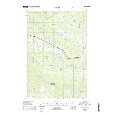
2020 Map of Ronald
USGS Topo · Published 2020About this map
Ronald and the western edge of Roslyn sit at the northern gateway to the Wenatchee National Forest, where the industrial and natural landscapes of Kittitas County converge. This 2020 survey reveals a complex network of water management and recreation, centered on the Cle Elum River and the expansive Cle Elum Lake. The southern reach of the Easton Ridge overlooks Domerie Flats, while the Yakima River snakes through the central valley, accompanied by the Main Canal and a dense web of rural transit routes like Nelson Siding Rd and the John Wayne trail. To the south, the terrain rises sharply toward Hicks Butte and the Little Creek Basin, highlighting the dramatic elevation changes that characterize the region between the high forest ridges and the settled valley floors near Nelson.
Find a feature on this map
104 named features on this map. Tap any name to fly to it.
Don’t see what you’re looking for? This feature index may not catch every label — zoom into the map to look around manually.
Map Details
Editions of this 2020 Ronald Map
This is the sole edition of this map. No revisions or reprints were ever made.
Other maps of this area

1897 · Mount Stuart
USGS Topo · 1:125,000

1901 · Snoqualmie Pass
USGS Topo · 1:125,000

1902 · Mount Stuart
USGS Topo · 1:125,000

1903 · Snoqualmie
USGS Topo · 1:125,000

1957 · Wenatchee
USGS Topo · 1:250,000

1958 · Cle Elum
USGS Topo · 1:62,500

1961 · Mount Stuart
USGS Topo · 1:62,500

1961 · Easton
USGS Topo · 1:62,500

1961 · Kachess Lake
USGS Topo · 1:62,500

1975 · Snoqualmie Pass
USGS Topo · 1:100,000