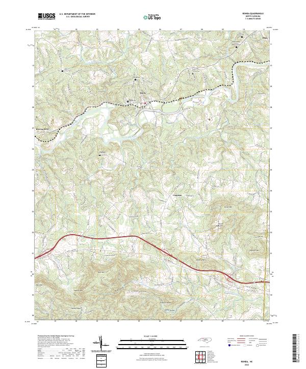
2022 Map of Ronda
USGS Topo · Published 2022About this map
The Yadkin River defines the central topography of this Wilkes County landscape, winding between the northern valley floor and the rising southern peaks of the Brushy Mountains. The settlement of Ronda sits at a critical bend in the river, serving as a focal point for local history with sites like the Ronda Baptist Cem and Ronda Cem. To the west, the community of Roaring River marks the confluence of its namesake tributary, while the terrain to the south becomes increasingly complex with named features such as Gobblers Knob, Dark Mtn, and Mathis Mtn.
Find a feature on this map
132 named features on this map. Tap any name to fly to it.
Don’t see what you’re looking for? This feature index may not catch every label — zoom into the map to look around manually.
Map Details
Editions of this 2022 Ronda Map
This is the sole edition of this map. No revisions or reprints were ever made.
Other maps of this area

1889 · Wilkesboro
USGS Topo · 1:125,000

1891 · Wilkesboro
USGS Topo · 1:125,000

1891 · Yadkinville
USGS Topo · 1:125,000

1893 · Yadkinville
USGS Topo · 1:125,000

1953 · Winston-Salem
USGS Topo · 1:250,000

1955 · Winston-Salem
USGS Topo · 1:250,000

1962 · Winston-Salem
USGS Topo · 1:250,000
1966 · Gilreath
USGS Topo · 1:24,000

1966 · Roaring River
USGS Topo · 1:24,000
1968 · Traphill
USGS Topo · 1:24,000