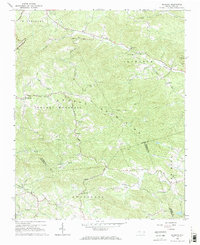
1966 Map of Gilreath
USGS Topo · Published 1968About this map
Brushy Mountain dominates the center of this mid-1960s landscape, serving as a physical divide between the watersheds of Hunting Creek to the north and the South Yadkin River to the south. The area is characterized by a high density of rural community centers, primarily anchored by numerous small churches and cemeteries like Cherry Grove Ch and Old Bethany Cem. This settlement pattern suggests a deeply rooted local history where social life was organized around church congregations and family ridges.
Find a feature on this map
42 named features on this map. Tap any name to fly to it.
Don’t see what you’re looking for? This feature index may not catch every label — zoom into the map to look around manually.
Map Details
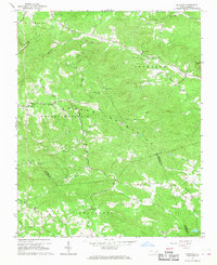
Editions of this 1966 Gilreath Map
2 editions found
Other maps of this area

1889 · Wilkesboro
USGS Topo · 1:125,000

1891 · Wilkesboro
USGS Topo · 1:125,000

1891 · Yadkinville
USGS Topo · 1:125,000

1893 · Statesville
USGS Topo · 1:125,000

1893 · Yadkinville
USGS Topo · 1:125,000

1895 · Hickory
USGS Topo · 1:125,000

1953 · Charlotte
USGS Topo · 1:250,000

1953 · Winston-Salem
USGS Topo · 1:250,000

1954 · Charlotte
USGS Topo · 1:250,000

1955 · Winston-Salem
USGS Topo · 1:250,000