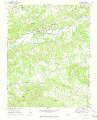
1971 Map of Ronda
USGS Topo · Published 1973About this map
The Yadkin River winds through the heart of Wilkes County in the early 1970s, defining the landscape between the valley floor and the northern edges of the Brushy Mountains. The Southern railroad line parallels the river, connecting rural hubs like Ronda and Roaring River. This era shows a community structured around its landmarks, including the East Wilkes High School and Ronda-Clingman School, which served the decentralized settlements of Clingman and Dennyville.
Find a feature on this map
45 named features on this map. Tap any name to fly to it.
Don’t see what you’re looking for? This feature index may not catch every label — zoom into the map to look around manually.
Map Details
Editions of this 1971 Ronda Map
This is the sole edition of this map. No revisions or reprints were ever made.
Other maps of this area

1889 · Wilkesboro
USGS Topo · 1:125,000

1891 · Wilkesboro
USGS Topo · 1:125,000

1891 · Yadkinville
USGS Topo · 1:125,000

1893 · Yadkinville
USGS Topo · 1:125,000

1953 · Winston-Salem
USGS Topo · 1:250,000

1955 · Winston-Salem
USGS Topo · 1:250,000

1962 · Winston-Salem
USGS Topo · 1:250,000
1966 · Gilreath
USGS Topo · 1:24,000

1966 · Roaring River
USGS Topo · 1:24,000
1968 · Traphill
USGS Topo · 1:24,000