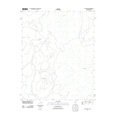
2011 Map of Roof Butte
USGS Topo · Published 2011About this map
Roof Butte stands as a prominent topographical anchor in this high-elevation landscape within the Tunitcha Mountains of the Arizona and New Mexico border region. The area is defined by its complex drainage network, where seasonal watercourses like Red Wash and Sanostee Wash carve through the high desert. A system of tribal routes, including Indian Rte 13 and Indian Rte 68, provides the primary transit corridors through this terrain. Historically significant water sources are documented here, such as Narrow Creek Spring and the curiously numbered 12R-66 Spring. The presence of Snake Bridge along the eastern washes indicates localized infrastructure built to navigate the shifting desert floor. This 2011 survey illustrates the continued reliance on established Indian Service routes for connecting the high mountain ridges with the expansive wash basins below.
Find a feature on this map
18 named features on this map. Tap any name to fly to it.
Don’t see what you’re looking for? This feature index may not catch every label — zoom into the map to look around manually.
Map Details
Editions of this 2011 Roof Butte Map
This is the sole edition of this map. No revisions or reprints were ever made.
Other maps of this area

1889 · Chaco
USGS Topo · 1:250,000

1892 · Chaco
USGS Topo · 1:250,000

1892 · Canyon De Chelly
USGS Topo · 1:250,000

1934 · Ship Rock
USGS Topo · 1:62,500

1937 · Ship Rock
USGS Topo · 1:62,500

1953 · Sanostee
USGS Topo · 1:62,500

1953 · Redrock Valley SE
USGS Topo · 1:24,000

1953 · Redrock Valley SW
USGS Topo · 1:24,000

1953 · Redrock Valley
USGS Topo · 1:62,500

1954 · Shiprock
USGS Topo · 1:250,000