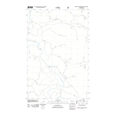
2011 Map of Roosevelt Creek East
USGS Topo · Published 2011About this map
The Little Missouri River carves a winding path through this portion of Billings County, anchoring a landscape defined by the drainage networks of Roosevelt Creek, Mikes Creek, and Blacktail Creek. The terrain is punctuated by the prominent Black-Top Butte, which overlooks a series of isolated homesteads and ranching operations. These traditional land holdings, including Buckhorn Ranch, Mosser Ranch, and Short Ranch, are connected by a sparse network of unpaved tracks such as Short Rd and E River Rd. This survey reflects the enduring cattle-ranching culture of the North Dakota Badlands, where the relationship between reliable water sources and settlement remains central to the geography. The absence of developed townsites highlights the rural character of this region, where the primary infrastructure consists of ranch roads and the natural contours of the Missouri River valley.
Find a feature on this map
13 named features on this map. Tap any name to fly to it.
Don’t see what you’re looking for? This feature index may not catch every label — zoom into the map to look around manually.
Map Details
Editions of this 2011 Roosevelt Creek East Map
This is the sole edition of this map. No revisions or reprints were ever made.
Other maps of this area

1953 · Watford City
USGS Topo · 1:250,000

1957 · Watford City
USGS Topo · 1:250,000

1963 · Gorham SW
USGS Topo · 1:24,000

1963 · Gorham NW
USGS Topo · 1:24,000

1967 · Watford City
USGS Topo · 1:250,000

1970 · Eagle Draw
USGS Topo · 1:24,000

1970 · Hanks Gully
USGS Topo · 1:24,000

1970 · Wannagan Creek East
USGS Topo · 1:24,000

1970 · Roosevelt Creek East
USGS Topo · 1:24,000

1974 · Squaretop Butte
USGS Topo · 1:24,000