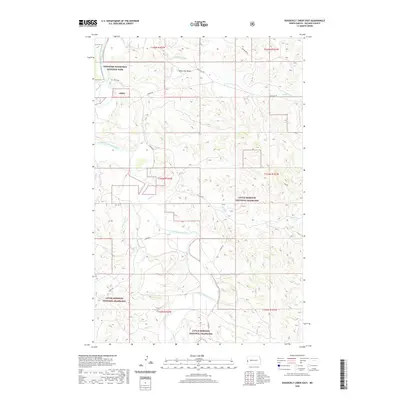
2020 Map of Roosevelt Creek East
USGS Topo · Published 2020About this map
The Little Missouri River carves a winding path through this portion of Billings County, defining the drainage patterns for numerous local tributaries. The landscape is dominated by the protected expanses of the Theodore Roosevelt National Park in the northwest and the expansive Little Missouri National Grassland throughout the central and southern sections. Topographic variations are anchored by landmarks like Black Top Butte, which rises above the surrounding badlands and prairie. A sparse network of rural routes, including E River Rd and Blacktail Rd, provides access to the remote river valley and the drainages of Blacktail Cr, Mikes Cr, and Roosevelt Cr. The map captures the specialized land management of the North Dakota badlands, where public conservation lands and national park boundaries intersect with the natural flow of the Little Missouri watershed.
Find a feature on this map
18 named features on this map. Tap any name to fly to it.
Don’t see what you’re looking for? This feature index may not catch every label — zoom into the map to look around manually.
Map Details
Editions of this 2020 Roosevelt Creek East Map
This is the sole edition of this map. No revisions or reprints were ever made.
Other maps of this area

1953 · Watford City
USGS Topo · 1:250,000

1957 · Watford City
USGS Topo · 1:250,000

1963 · Gorham SW
USGS Topo · 1:24,000

1963 · Gorham NW
USGS Topo · 1:24,000

1967 · Watford City
USGS Topo · 1:250,000

1970 · Eagle Draw
USGS Topo · 1:24,000

1970 · Hanks Gully
USGS Topo · 1:24,000

1970 · Wannagan Creek East
USGS Topo · 1:24,000

1970 · Roosevelt Creek East
USGS Topo · 1:24,000

1974 · Squaretop Butte
USGS Topo · 1:24,000