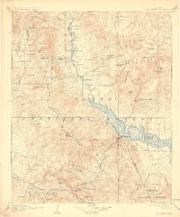
1912 Map of Roosevelt
USGS Topo · Published 1928About this map
Roosevelt Dam dominates the landscape of this 1912 survey, anchoring the massive Roosevelt Reservoir at the confluence of Tonto Creek and the Salt River. This early century depiction captures the region's transition into a managed water system, with an Electric Power Line already cutting across the terrain toward Schell's Station. The map serves as a detailed record of pioneer-era ranching and logistics, showing numerous family holdings such as Sunflower Ranch, Cline's Ranch, and Howell's Ranch scattered along the mountain drainages.
Find a feature on this map
89 named features on this map. Tap any name to fly to it.
Don’t see what you’re looking for? This feature index may not catch every label — zoom into the map to look around manually.
Map Details
Editions of this 1912 Roosevelt Map
4 editions found

Other maps of this area

1886 · Holbrook
USGS Topo · 1:250,000

1887 · Verde
USGS Topo · 1:250,000

1892 · Verde
USGS Topo · 1:250,000

1893 · Holbrook
USGS Topo · 1:250,000

1900 · Florence
USGS Topo · 1:125,000

1901 · Globe
USGS Topo · 1:62,500

1902 · Globe
USGS Topo · 1:62,500

1902 · Florence
USGS Topo · 1:125,000

1904 · Desert Well
USGS Topo · 1:62,500

1904 · Ft. McDowell
USGS Topo · 1:62,500