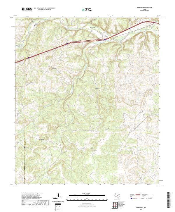
2022 Map of Roosevelt
USGS Topo · Published 2022About this map
Roosevelt serves as the central hub of this Kimble County landscape, situated where the North Llano River meets the drainages of Maynard Creek. The terrain is defined by dramatic relief, ranging from the prominent Cedar Knob and the high elevations of Patterson Ridge to the deep incisions of Spring Hollow and Buck Hollow. This 2022 survey captures the contemporary road network, including the path of Old Hwy 290 and numerous ranch roads like Eubanks Lane Davis Rd that snake through the limestone-cut valleys.
Find a feature on this map
43 named features on this map. Tap any name to fly to it.
Don’t see what you’re looking for? This feature index may not catch every label — zoom into the map to look around manually.
Map Details
Editions of this 2022 Roosevelt Map
This is the sole edition of this map. No revisions or reprints were ever made.
Other maps of this area

1893 · Rock Springs
USGS Topo · 1:125,000

1893 · Fort McKavett
USGS Topo · 1:125,000

1926 · Segovia 2-c
USGS Topo · 1:48,000

1932 · Junction
USGS Topo · 1:62,500

1954 · Llano
USGS Topo · 1:250,000

1954 · Sonora
USGS Topo · 1:250,000

1955 · Llano
USGS Topo · 1:250,000

1956 · Llano
USGS Topo · 1:250,000

1958 · Sonora
USGS Topo · 1:250,000

1962 · Hill Ranch
USGS Topo · 1:24,000