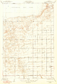
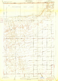
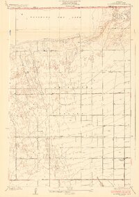
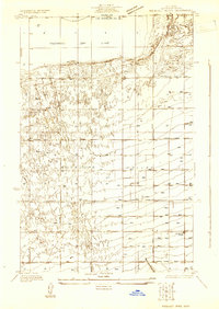
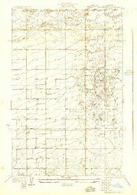
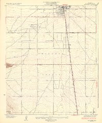
1933 Map of Roosevelt School
USGS Topo · Published 1949About this map
Antelope Valley stretches across this landscape at the intersection of the Kern Co Los Angeles Co boundary. The northern extent is dominated by the flat expanse of Rosamond Dry Lake, while the remainder of the terrain is defined by a rigid grid of early road development. This geometric settlement pattern, largely comprising numbered and lettered thoroughfares like Avenue A and Avenue D, suggests the systematic agricultural and residential parceling of the high desert during this era.
Find a feature on this map
21 named features on this map. Tap any name to fly to it.
Don’t see what you’re looking for? This feature index may not catch every label — zoom into the map to look around manually.
Map Details
Editions of this 1933 Roosevelt School Map
3 editions found
Other maps of this area

1915 · Elizabeth Lake
USGS Topo · 1:125,000

1917 · Elizabeth Lake
USGS Topo · 1:125,000

1930 · Oban
USGS Topo · 1:24,000
1930 · Roosevelt School
USGS Topo · 1:24,000
1930 · Casa Desierta
USGS Topo · 1:24,000
1930 · Lancaster
USGS Topo · 1:24,000
1930 · West Alpine Butte
USGS Topo · 1:24,000
1930 · Tierra Bonita
USGS Topo · 1:24,000
1933 · Lancaster
USGS Topo · 1:24,000
1933 · Casa Desierta
USGS Topo · 1:24,000