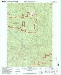
1997 Map of Rooster Rock
USGS Topo · Published 1999About this map
The Table Rock Wilderness dominates this corner of the Cascade Range, defined by its high volcanic plateaus and steep drainages. In this late 20th-century landscape, industrial history and natural preservation intersect at the Ogle Mtn Mine near Ogle Mountain, reflecting the area's legacy of resource extraction. The terrain is a complex meeting point of administrative boundaries, where the Santiam State Forest, Mt Hood National Forest, and Willamette National Forest converge near the Clackamas and Marion County line. Notable summits like Table Rock, Nasty Rock, and Rooster Rock provide vertical relief above the Molalla River and its numerous tributaries, including Table Rock Fork and Copper Creek. The presence of a Peshuck Lookout and several quarries suggests a landscape managed for both timber and fire observation during this era.
Find a feature on this map
36 named features on this map. Tap any name to fly to it.
Don’t see what you’re looking for? This feature index may not catch every label — zoom into the map to look around manually.
Map Details
Editions of this 1997 Rooster Rock Map
This is the sole edition of this map. No revisions or reprints were ever made.
Other maps of this area

1916 · Estacada
USGS Topo · 1:125,000

1929 · Mill City
USGS Topo · 1:125,000

1948 · Vancouver
USGS Topo · 1:250,000

1950 · Vancouver
USGS Topo · 1:250,000

1950 · Vancouver
USGS Topo · 1:250,000

1953 · Salem
USGS Topo · 1:250,000

1954 · Salem
USGS Topo · 1:250,000

1955 · Colton
USGS Topo · 1:62,500

1955 · Mill City
USGS Topo · 1:62,500

1956 · Fish Creek Mtn
USGS Topo · 1:62,500