
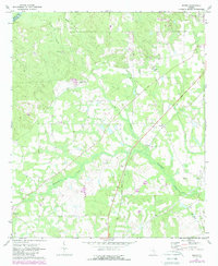
1971 Map of Roper
USGS Topo · Published 1974About this map
The border of Telfair Co and Jeff Davis Co defines the northern reaches of this rural landscape, where agriculture and forestry intersect in south-central Georgia. The Georgia Central railroad cuts a straight diagonal through the terrain, passing through the small community of Roper and heading southwest toward Snipesville. This corridor was essential for the movement of timber and agricultural goods from the surrounding pine woods and fields.
Find a feature on this map
16 named features on this map. Tap any name to fly to it.
Don’t see what you’re looking for? This feature index may not catch every label — zoom into the map to look around manually.
Map Details
Editions of this 1971 Roper Map
2 editions found
Other maps of this area

1953 · Waycross
USGS Topo · 1:250,000

1958 · Waycross
USGS Topo · 1:250,000

1971 · Nicholls NE
USGS Topo · 1:24,000

1971 · Jacksonville NE
USGS Topo · 1:24,000

1971 · Snipesville
USGS Topo · 1:24,000
1971 · Hazlehurst North
USGS Topo · 1:24,000

1971 · Broxton NE
USGS Topo · 1:24,000

1971 · Hazlehurst South
USGS Topo · 1:24,000

1971 · Denton
USGS Topo · 1:24,000
1971 · Lumber City
USGS Topo · 1:24,000