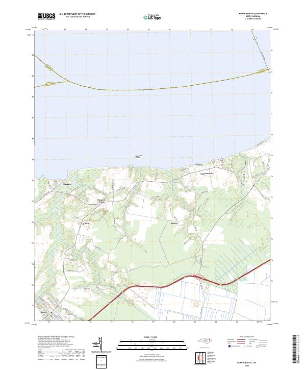
2022 Map of Roper North
USGS Topo · Published 2022About this map
Mackeys and Skinnersville anchor this coastal landscape along the southern edge of the Albemarle Sound, where the transition from water to land is defined by low-lying wetlands and a network of drainage channels. The town of Roper sits in the southwestern corner, situated near the headwaters of Kendrick Cr. The map reveals a land heavily influenced by its proximity to the sound, with shoreline features like Batemans Beach and Learys Beach connected to the interior by a dense web of local roads such as Mackeys Rd and Holly Neck Rd. Smaller agricultural and residential nodes like Beasley, Blount, and Pleasant Grove are interspersed among the creeks and branches, including Whites Creek and Hawkins Br. Engineering of the landscape is evident in the prominent Main Canal, which cuts across the terrain to manage the drainage of these coastal lowlands.
Find a feature on this map
55 named features on this map. Tap any name to fly to it.
Don’t see what you’re looking for? This feature index may not catch every label — zoom into the map to look around manually.
Map Details
Editions of this 2022 Roper North Map
This is the sole edition of this map. No revisions or reprints were ever made.
Other maps of this area

1904 · Edenton
USGS Topo · 1:62,500

1906 · Hertford
USGS Topo · 1:62,500

1940 · Hertford
USGS Topo · 1:62,500

1942 · Edenton
USGS Topo · 1:62,500

1943 · Columbia
USGS Topo · 1:125,000

1943 · Plymouth
USGS Topo · 1:125,000

1943 · Edenton
USGS Topo · 1:62,500

1953 · Norfolk
USGS Topo · 1:250,000

1953 · Rocky Mount
USGS Topo · 1:250,000

1954 · Rocky Mount
USGS Topo · 1:250,000