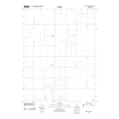
2010 Map of Roper School
USGS Topo · Published 2010About this map
Roper School anchors this rural landscape east of Denver in the early 21st century, where the prairie begins to transition from open ranch land to structured agricultural parcels. The drainage network is defined by the northward flow of Wolf Creek and Comanche Creek, which carve subtle paths through the terrain. The map reveals an interesting intersection of traditional farming and modern aviation, specifically through specialized landing strips like the Comanche Livestock Airport and Bowen Farms Number 2 Airport. The road system, including evocatively named routes such as Pass Me By Rd and Headlight Rd, follows a strict section-line grid typical of the Great Plains. This survey captures a moment of quiet rural utility, documenting the water sources and small-scale infrastructure that sustain the livestock and farming operations of eastern Adams County.
Find a feature on this map
27 named features on this map. Tap any name to fly to it.
Don’t see what you’re looking for? This feature index may not catch every label — zoom into the map to look around manually.
Map Details
Editions of this 2010 Roper School Map
This is the sole edition of this map. No revisions or reprints were ever made.
Other maps of this area

1949 · Sunnydale
USGS Topo · 1:24,000

1949 · Bennett
USGS Topo · 1:24,000

1950 · Roper School
USGS Topo · 1:24,000

1951 · Roper School
USGS Topo · 1:24,000

1951 · Living Springs
USGS Topo · 1:24,000

1951 · Leader NW
USGS Topo · 1:24,000

1952 · Leader SW
USGS Topo · 1:24,000

1953 · Denver
USGS Topo · 1:250,000

1955 · Strasburg NW
USGS Topo · 1:24,000

1955 · Strasburg
USGS Topo · 1:24,000