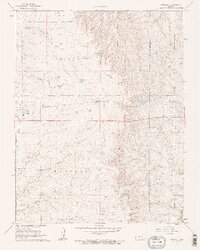
1961 Map of Rosalia
USGS Topo · Published 1962About this map
The Old Indian Boundary cuts through this landscape, marking a significant historical surveyor's line that separates the township units of Rosalia, Blankinship, and South Salem. The terrain is defined by the winding course of the Little Walnut River and its various tributaries, including the North Branch, Middle Branch, and De Haas Creek. The Missouri Pacific railroad traverses the northern half of the quadrangle, serving the small community of Rosalia and the isolated depot at Sallyards.
Find a feature on this map
25 named features on this map. Tap any name to fly to it.
Don’t see what you’re looking for? This feature index may not catch every label — zoom into the map to look around manually.
Map Details
Editions of this 1961 Rosalia Map
2 editions found
Other maps of this area

1885 · Eureka
USGS Topo · 1:125,000

1888 · Eureka
USGS Topo · 1:125,000

1888 · Eldorado
USGS Topo · 1:125,000

1894 · Eureka
USGS Topo · 1:125,000

1955 · Wichita
USGS Topo · 1:250,000

1958 · Wichita
USGS Topo · 1:250,000

1961 · Pontiac
USGS Topo · 1:24,000

1961 · Rosalia NE
USGS Topo · 1:24,000

1961 · Rosalia
USGS Topo · 1:24,000
1961 · Rosalia NW
USGS Topo · 1:24,000