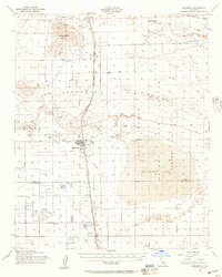
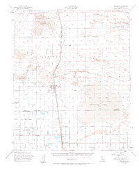
1956 Map of Rosamond
USGS Topo · Published 1957About this map
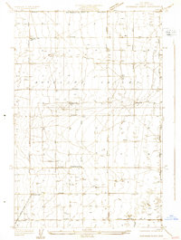
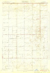
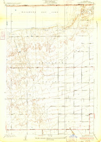
Gold mining operations and aerospace expansion dominate the high desert landscape of Rosamond during the mid-1950s. The northern reaches of the map highlight intensive extraction efforts at Soledad Mtn, where the Elephant Eagle Mine, Golden Queen Mine, and Bobtail Mine are clearly marked alongside tailings and prospects. These industrial sites sit in stark contrast to the emerging military footprint of Edwards Air Force Base to the east, which encompasses the expansive Rosamond Lake dry bed and its associated flight test areas. The regional transportation network is anchored by the Southern Pacific railroad, serving a string of small settlements and sidings including Fleta, Ansel, and Oban. Near the Tropico Hill, the Tropico Shaft remains a prominent landmark of the local mining heritage, while the developing grid of avenues near the Kern and Los Angeles county line indicates the early stages of suburban desert expansion.
Find a feature on this map
41 named features on this map. Tap any name to fly to it.
Don’t see what you’re looking for? This feature index may not catch every label — zoom into the map to look around manually.
Map Details
Editions of this 1956 Rosamond Map
2 editions found
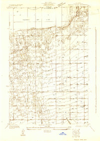
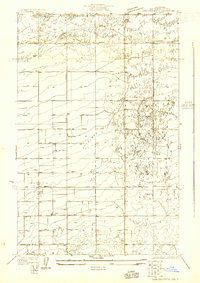
Other maps of this area

1915 · Elizabeth Lake
USGS Topo · 1:125,000

1915 · Searles Lake
USGS Topo · 1:250,000

1915 · Mojave
USGS Topo · 1:125,000

1917 · Elizabeth Lake
USGS Topo · 1:125,000

1930 · Oban
USGS Topo · 1:24,000
1930 · Roosevelt School
USGS Topo · 1:24,000
1930 · Casa Desierta
USGS Topo · 1:24,000
1931 · Esperanza School
USGS Topo · 1:24,000
1933 · Casa Desierta
USGS Topo · 1:24,000
1933 · Roosevelt School
USGS Topo · 1:24,000