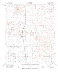
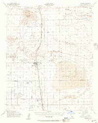
1956 Map of Rosamond
USGS Topo · Published 1964About this map
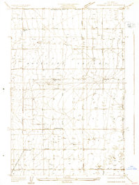
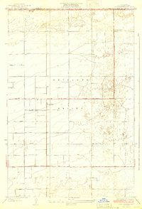
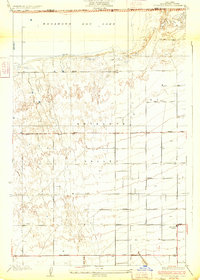
Elephant Eagle Mine, Golden Queen Mine, and the Bobtail Mine cluster around the prominent volcanic slopes of Soledad Mtn, marking a landscape defined by both mineral extraction and aerospace expansion. This mid-century survey captures the Mojave Desert during a period of transition, where the historic tracks of the Southern Pacific and Atchison Topeka and Santa Fe railroads intersect with the growing footprint of Edwards Air Force Base. The sprawling alkali flats of Rosamond Lake dominate the southeastern quadrant, providing the natural infrastructure for a Test Track and military aviation activities near the Rosamond Airport.
Find a feature on this map
43 named features on this map. Tap any name to fly to it.
Don’t see what you’re looking for? This feature index may not catch every label — zoom into the map to look around manually.
Map Details
Editions of this 1956 Rosamond Map
2 editions found
Other maps of this area

1915 · Elizabeth Lake
USGS Topo · 1:125,000

1915 · Searles Lake
USGS Topo · 1:250,000

1915 · Mojave
USGS Topo · 1:125,000

1917 · Elizabeth Lake
USGS Topo · 1:125,000

1930 · Oban
USGS Topo · 1:24,000
1930 · Roosevelt School
USGS Topo · 1:24,000
1930 · Casa Desierta
USGS Topo · 1:24,000
1931 · Esperanza School
USGS Topo · 1:24,000
1933 · Casa Desierta
USGS Topo · 1:24,000
1933 · Roosevelt School
USGS Topo · 1:24,000