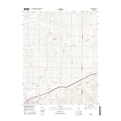
2015 Map of Rosati
USGS Topo · Published 2015About this map
Saint James serves as a significant anchor in the southwestern corner of this Phelps County landscape, where the Saint James Veterans Home Cemetery and Saint James Catholic Cemetery speak to the community's deep local roots. The terrain is defined by a series of north-flowing watercourses, including the Bourbeuse River and Clear Creek, which have shaped the settlement patterns of small clusters like Rosati and Flag Spring.
Find a feature on this map
69 named features on this map. Tap any name to fly to it.
Don’t see what you’re looking for? This feature index may not catch every label — zoom into the map to look around manually.
Map Details
Editions of this 2015 Rosati Map
This is the sole edition of this map. No revisions or reprints were ever made.
Other maps of this area

1903 · Sullivan
USGS Topo · 1:125,000

1928 · Meramec Spring
USGS Topo · 1:62,500

1932 · Steelville
USGS Topo · 1:48,000

1933 · Steelville
USGS Topo · 1:62,500

1934 · Redbird
USGS Topo · 1:62,500

1937 · Steelville
USGS Topo · 1:62,500

1938 · Redbird
USGS Topo · 1:62,500

1948 · Cuba
USGS Topo · 1:24,000

1948 · Oak Hill
USGS Topo · 1:24,000

1949 · Saint Louis
USGS Topo · 1:250,000