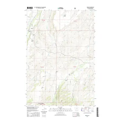
2017 Map of Roscoe
USGS Topo · Published 2017About this map
Roscoe and Luther serve as the primary anchors for this region of Carbon County, where the landscape is defined by a sophisticated system of high-altitude irrigation. Numerous waterworks including the Main Canal, Schock-Scott Ditch, and Peabody Ditch crisscross the terrain, supporting ranching operations situated between Spring Creek Bench and Sheep Mtn. The map reveals a deep connection to the land through numerous private burial sites, such as the Burnett Ranch Cem, Luoma Ranch Cem, and the lone Elessens Ranch Grave. These landmarks, alongside the northern edge of the Custer National Forest, illustrate a pattern of persistent family settlement. The network of local roads, such as Luther-Roscoe Rd and Volney Creek Rd, follows the natural contours of the drainages, connecting disparate homesteads to the small community hubs.
Find a feature on this map
63 named features on this map. Tap any name to fly to it.
Don’t see what you’re looking for? This feature index may not catch every label — zoom into the map to look around manually.
Map Details
Editions of this 2017 Roscoe Map
This is the sole edition of this map. No revisions or reprints were ever made.
Other maps of this area

1898 · Granite Mountain District
USGS Topo · 1:125,000

1932 · Red Lodge No 2
USGS Topo · 1:48,000

1932 · Nye No 1
USGS Topo · 1:48,000

1954 · Billings
USGS Topo · 1:250,000
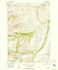
1956 · Fishtail
USGS Topo · 1:24,000

1956 · Roscoe
USGS Topo · 1:24,000

1956 · Alpine
USGS Topo · 1:62,500

1956 · Mackay Ranch
USGS Topo · 1:24,000

1956 · Roscoe NW
USGS Topo · 1:24,000

1956 · Roscoe NE
USGS Topo · 1:24,000