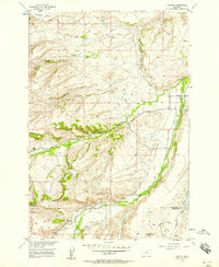
1956 Map of Fishtail
USGS Topo · Published 1957About this map
Fishtail serves as the focal point of this mid-century survey along the boundary of Stillwater Co and Carbon Co. The landscape is defined by an intricate network of irrigation systems supporting the local agricultural economy, including the Magee Ditch, West Rosebud Ditch, and Dempster Ditch, which divert water from the mountain runoff of West Rosebud Creek and Fishtail Creek. The terrain transitions from the elevated Fladberg Bench and Davidson plateau in the north into the deeply carved drainages of Murphy Canyon, Arney Canyon, and Box Canyon.
Find a feature on this map
31 named features on this map. Tap any name to fly to it.
Don’t see what you’re looking for? This feature index may not catch every label — zoom into the map to look around manually.
Map Details
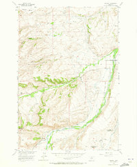
Editions of this 1956 Fishtail Map
2 editions found
Other maps of this area

1891 · Big Timber
USGS Topo · 1:125,000

1892 · Stillwater
USGS Topo · 1:125,000

1893 · Big Timber
USGS Topo · 1:125,000

1898 · Granite Mountain District
USGS Topo · 1:125,000

1932 · Red Lodge No 2
USGS Topo · 1:48,000

1932 · Nye No 1
USGS Topo · 1:48,000

1954 · Billings
USGS Topo · 1:250,000

1955 · Sandborn Creek
USGS Topo · 1:24,000

1955 · Absarokee
USGS Topo · 1:24,000
1955 · Cow Face Hill
USGS Topo · 1:24,000