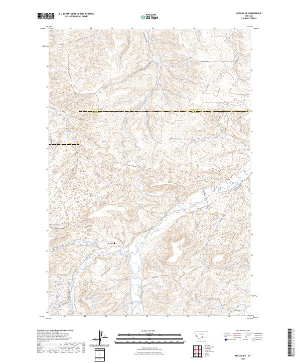
2024 Map of Roscoe NE
USGS Topo · Published 2024About this map
Red Lodge Creek and its complex network of tributaries define this landscape along the border of Stillwater and Carbon counties. This 2024 survey records a high-plains environment where water management is central to the land's utility, evidenced by the presence of the Inderland Ramsland Ditch and Canal S. These irrigation features, alongside various forks of Volney Creek and Whitebird Creek, illustrate a long history of water engineering in a region characterized by prominent terrain features like Spring Creek Bench. Cultural landmarks are sparse but significant for local history and genealogy, notably the Saint Olaf Cem located near the confluence of several creek roads. The map also detail local access routes named for early settler families and geographical landmarks, including Maki Hill Rd, McNaley Rd, and Joe Hill Creek Rd.
Find a feature on this map
30 named features on this map. Tap any name to fly to it.
Don’t see what you’re looking for? This feature index may not catch every label — zoom into the map to look around manually.
Map Details
Editions of this 2024 Roscoe NE Map
This is the sole edition of this map. No revisions or reprints were ever made.
Other maps of this area

1892 · Stillwater
USGS Topo · 1:125,000

1932 · Red Lodge No 2
USGS Topo · 1:48,000

1932 · Red Lodge No 1
USGS Topo · 1:48,000

1954 · Billings
USGS Topo · 1:250,000

1955 · Whitebird School
USGS Topo · 1:24,000

1955 · Absarokee
USGS Topo · 1:24,000

1956 · Roscoe
USGS Topo · 1:24,000

1956 · Shane Ridge
USGS Topo · 1:24,000

1956 · Roscoe NW
USGS Topo · 1:24,000

1956 · Roscoe NE
USGS Topo · 1:24,000