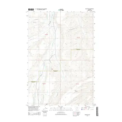
2014 Map of Roscoe NW
USGS Topo · Published 2014About this map
Rosebud Creek and its many tributaries anchor this detailed look at the rural borderlands between Stillwater and Carbon counties. The landscape is defined by an intricate network of irrigation systems, reflecting a long history of cattle ranching and agricultural development. Names like the Ross-Flannigan-Ditch, Sylvester-Beasley Ditch, and Selleck-Espeland Ditch reveal the family legacies imprinted on the land. The topography rises toward high vantage points such as Yancey Hill and the broad plateaus of Coleman Bench and Spring Creek Bench. Cultural history is noted along the northern edge with roads such as Plenty Coups Rd and the Crow Child Trl, while Smith Bridge provides a crossing over the creek as the geography shifts between mountain-fed waters and open plains.
Find a feature on this map
45 named features on this map. Tap any name to fly to it.
Don’t see what you’re looking for? This feature index may not catch every label — zoom into the map to look around manually.
Map Details
Editions of this 2014 Roscoe NW Map
This is the sole edition of this map. No revisions or reprints were ever made.
Other maps of this area

1891 · Big Timber
USGS Topo · 1:125,000

1892 · Stillwater
USGS Topo · 1:125,000

1893 · Big Timber
USGS Topo · 1:125,000

1898 · Granite Mountain District
USGS Topo · 1:125,000

1932 · Red Lodge No 2
USGS Topo · 1:48,000

1932 · Nye No 1
USGS Topo · 1:48,000

1954 · Billings
USGS Topo · 1:250,000

1955 · Sandborn Creek
USGS Topo · 1:24,000

1955 · Whitebird School
USGS Topo · 1:24,000

1955 · Absarokee
USGS Topo · 1:24,000