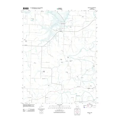
2011 Map of Roscoe
USGS Topo · Published 2011About this map
The Osage River and Sac River converge in this section of St. Clair County, creating a landscape defined by meandering waterways and distinct bluff formations. The village of Roscoe serves as a central point, situated near the river junction and the Pasley Airport. This area is rich in family and community history, evidenced by numerous burial grounds such as Moore Cemetery, Culbartson Cemetery, and the curiously named Love Mound Cemetery.
Find a feature on this map
97 named features on this map. Tap any name to fly to it.
Don’t see what you’re looking for? This feature index may not catch every label — zoom into the map to look around manually.
Map Details
Editions of this 2011 Roscoe Map
This is the sole edition of this map. No revisions or reprints were ever made.
Other maps of this area

1886 · Stockton
USGS Topo · 1:125,000

1887 · Clinton
USGS Topo · 1:125,000

1894 · Clinton
USGS Topo · 1:125,000

1937 · Tiffin
USGS Topo · 1:31,680

1938 · Monegaw Springs
USGS Topo · 1:24,000

1938 · Roscoe
USGS Topo · 1:24,000

1938 · Vista
USGS Topo · 1:24,000

1938 · Taberville
USGS Topo · 1:24,000

1939 · Caplinger Mills
USGS Topo · 1:24,000

1939 · Osceola
USGS Topo · 1:24,000